Day 27 - Thursday, June 6th - Topeka, KS to St Joseph, MO


Distance: 85.4 miles
Elevation Gain: 2755 ft. or 32.3 ft./mile
Net elevation change: +72 ft.
Click Here to Ride Along !!
Today we crossed our sixth state line and went into our seventh state when we left Kansas and entered Missouri at about mile 58 when we crossed the Missouri River. That was probably the highlight of the ride. As pleasant as the roads and scenery were yesterday, today was no comparison as we dealt with bad pavement (especially in Missouri), lots of trucks and a headwind for about half of the ride. Cloud cover for most of the day helped with the heat. Elevation gain was about 2000 feet less than yesterday, but for me it was a slow day as I was still tired from yesterday. Could have used about another three hours of sleep. Not a lot of pictures today as the scenery was for the most part uninspiring.
After a short trip north on Wanamaker Road out of the hotel we turned east on Huntoon Street and about 5 miles down the road we turned northeast on Kansas St and crossed the Kansas River at the 6 mile mark .

I have a thing for old churches

Obviously the "front door" to Topeka. I guess we came in the back door yesterday.
The Kansas River
At mile 8.5 we turned east on US-24 for four miles where we exited and turned north on KS-4 and proceeded to Meriden, a town of about 800 people. Founded in 1872 it was named by a pioneer settler for his former hometown of Meriden, New Hampshire.


At mile 32 we reached Valley Falls, our first SAG stop and a town of about 1200 people founded in 1854 and originally named Grasshopper Falls. On the way out of town we crossed the Delaware River. Have to admit I did a double take when I saw that sign. Seems this Delaware River was originally named the Grasshopper River. The town was incorporated in 1869 and the grasshopper invasion of the 1870's devastated the area. This was not a good promotional tool for the young town so with the help of the legislature, the river was renamed the Delaware after the Native American Tribe most dominant in the region. The town was renamed at least two more times and finally became Valley Falls.
Some decent shots from the road to the SAG stop and the Delaware River.


Not anything like the real Delaware River.
At mile 42 we reached Nortonville, a town of 630 people founded in 1873 and named after TL Norton, a favorite roadmaster on the crew building the railroad. It seems he would park his railroad car on the hill at a siding that became “Norton’s Place” and subsequently the town was named Nortonville.
KS-4 ends in Nortonville and becomes US-59 and at mile 56 we reached Atchison, our second SAG stop and a city of 11,000 that is the county seat of Atchison County. The city is named for David Rice Atchison, a US senator from Missouri as well a pro-slavery activist who was heavily involved in violence against abolitionists and free-staters during the “Bleeding Kansas” events between 1854 and 1861. Atchison was also the original eastern terminus for the Atchison, Topeka and Santa Fe Railroad as well as the birthplace of Amelia Earhart.

Starting to look a bit like NJ with cornfields in odd shaped parcels of land with random trees and bushes in the field.

Atchinson Cemetery located outside the city limits.

This was one big grain elevator. I couldn't get it all in the frame.

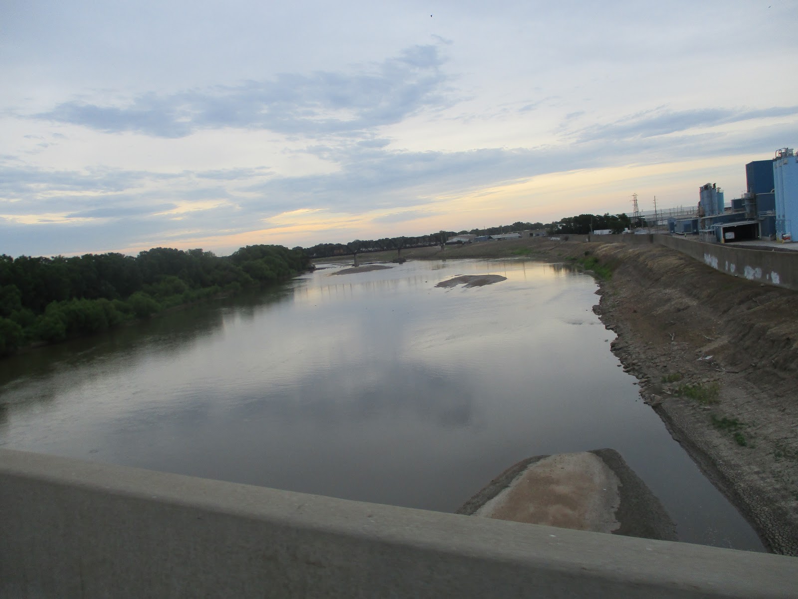
Leaving Atchison we headed due east and crossed the Missouri river into Missouri at mile 57. The Missouri is the longest river in the US traversing 2,341 miles starting in the Rocky Mountains in western Montana and entering the Mississippi north of St Louis. When combined with the lower Mississippi, it is the fourth longest river in the world.


At mile 64 we reached Rushville, a village of about 300 people, founded in 1847 and named from the deep growth of rushes nearby and at mile 76 we reach the outskirts of St Joseph. We still had 10 miles to the hotel and a good portion of that was along the SW Parkway which was a pretty quiet road through a large park area with covered picnic areas and large shade producing trees. It was also quite hilly and reminded me of Fairmount Park in Philadelphia. Because of the climbing and me wanting to just be done I only got one picture and it really doesn't do the route justice.

Sneak Peek at Tomorrow
87 miles to Chillicothe, MO with 3800 feet of climbing, about 1000 more than today and comparable to the 106 mile day into Topeka based on feet of elevation gain per mile. I've been told that it is mostly a series of rollers that are spaced such that your downward momentum carries you a good way up the next roller. We will see about that. I'm hoping my energy level is a bit better tomorrow.
Chillicothe is a city of
9500 people, Shawnee for “big-town” and is named after a large
Shawnee village that was located nearby.
According to the city’s website, Chillicothe is the home of sliced
bread. It was first offered for sale in 1828 by the Chillicothe Bakery and was
sliced by the Rohwedder Bread slicer, an invention of Iowa inventor Otto
Rohwedder. July 7th is Sliced Bread Day!


Comments
Post a Comment