Day 47 - Wednesday, June 27th - Latham, NY to Brattleboro, VT - 110 to go


Distance: 75.4 miles
Elevation Gain: 5360 ft. or 71.1 ft./mile
Net elevation change: -26 ft.
In looking to summarize the day one word kept popping into my head. GREEN! Once we left New York the roads seemed to narrow and the trees seemed to be taller. Combine this with the all day overcast sky and and green seemed to be everywhere. A combination of magnificent and suffocating at times. Today was the second biggest climbing day on the tour with nearly 5400 feet of climbing. Nearly 2800 feet of that came in three climbs. The first climb started a bit past the 5 mile mark, went for 3 miles and gained 630 feet. The second was by far the toughest and started at mile 34, went for 8 miles and gained 1526 feet. Definitely the longest climb I have ever done. The third climb was up Hogback Mountain (a great name for a mountain!) and started at about mile 55. It gained about 630 feet and was the most picturesque of the three.
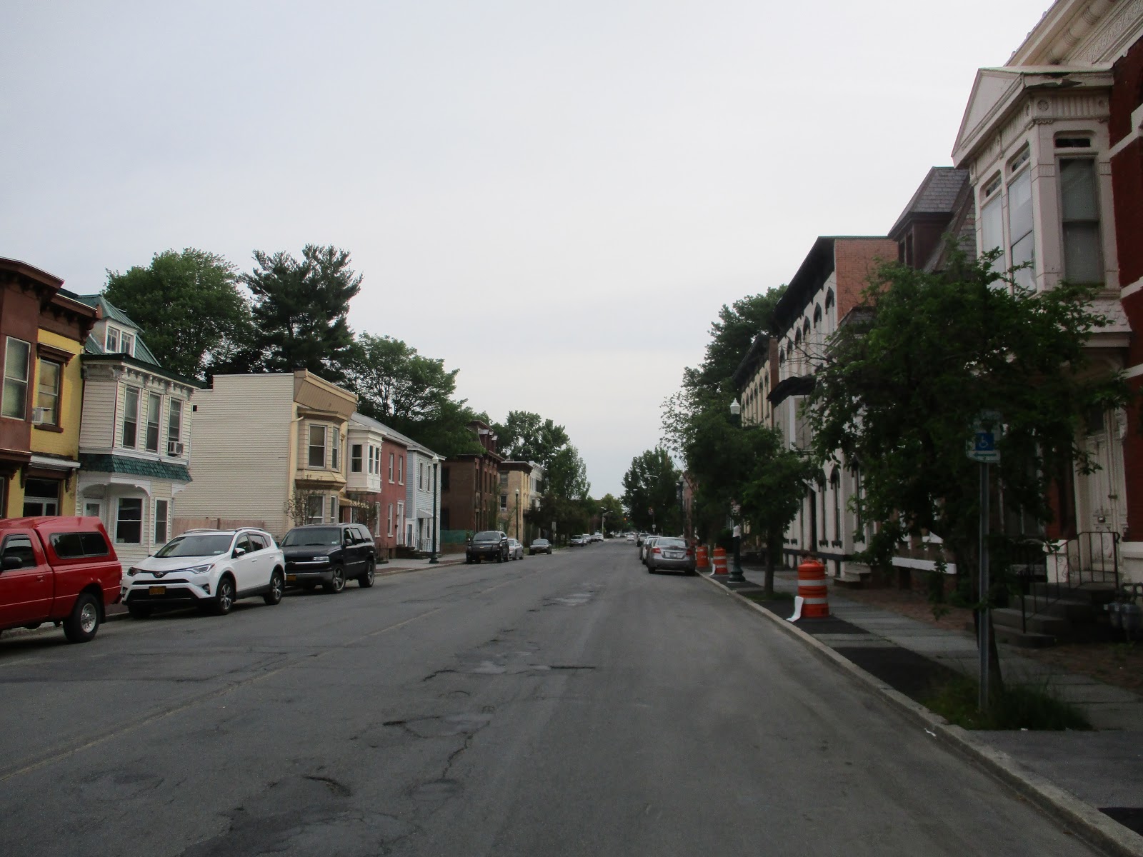
Out of the hotel we went to the northeast and rode through Cohoes at the 3 mile mark. Less then a mile later we crossed the Mohawk River onto Van Schaick Island and shortly after that we crossed the Hudson River and went north on US 4. Cohoes is a city of of over 16,000 and is called the "spindle city" because of the importance of textile manufacturing in the 19th century when the city's factories processed cotton from the Deep South, produced on plantations in the slave states. Van Shaick Island is within the boundaries of Cohoes and was first seen by the European explorer Henry Hudson. Beause of his exploration the island and the entire watershed of the Hudson River became the part of the Dutch colony of New Netherland.


Cohoes

Hudson River
Van Schaick
Continuing to the northeast on local roads we turned north on NY 7 at mile 12 and went through Raymertown at mile 13 and crossed the Tomhannock Reservoir which is
the water source for the city of Troy, New York. The reservoir is 5.5 miles long, and holds 12.3 billion US gallons when full.


The town of Pittstown was next at mile 16. With a population of 5700 it was created in 1788.


Continuing on NY 7 we reached Hoosick at mile 26. With a population of nearly 7000 the town was founded in 1788 and named after the Hoosick River, a 76 mile tributary of the Hudson River.


While still in Hoosick we came upon these enterprising folks looking to capitalize on the reputation of Vermont.


These folks haven't fared so well

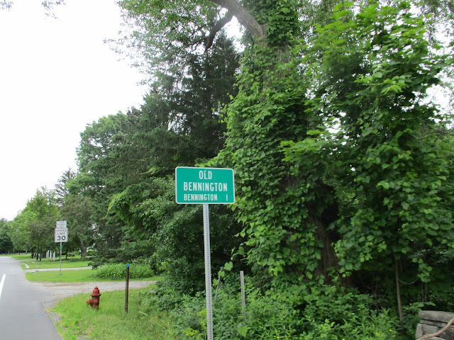
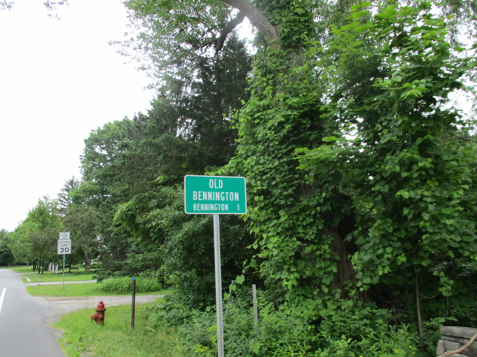
Just past the 29 mile mark we crossed the Vermont state line and reached Bennington at mile 34.


Bennington is one of 2 county seats which locally are known as shire towns (I feel like I've been transported into the Hobbit). With a population of over 15,000, Bennington was part of many land grants made by the province of New Hampshire for land west of the Connecticut River that just so happened to be land that was claimed by the province of New York. This dispute ultimately led to the formation of the Province of New Hampshire which became the state of New Hampshire. The original part of Bennington is Old Bennington and was settled in 1761 when Congregational Separatists from Connecticut and Massachusetts arrived in the area.


At mile 36 we entered the Green Mountain and Finger Lakes National Forests and passed through Woodford at mile 41, a town of just over 400 people followed by Searsburg at mile 49. Searsburg is an even smaller town with just over 100 residents that also happens to be home to a 6 megawatt wind turbine farm owned by Green Mountain Power.
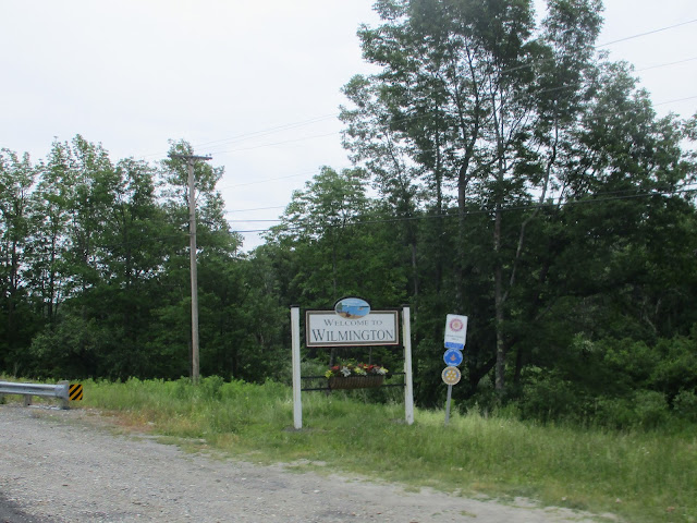
Wilmington was next at mile 54. The town has a population of nearly 1900 and was chartered in 1751 by Benning Wentworth, the colonial governor of New Hampshire and named in honor of Spencer Compton, 1st Earl of Wilmington. At this point we started the ascent of Hogback Mountain. It wasn't the hardest climb of the day, but the top was definitely the best. Here are the pictures of Wilmington and the top of Hogback.


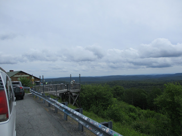

The top of Hogback Mountain was at mile 58 leaving us roughly 16 miles to our hotel. There are no pictures until we get to West Brattleboro at about mile mile 70. That is because the previous 12 miles were all downhill. Picture taking was not a high priority.
Just a couple from when we got into Brattleboro.


These folks haven't fared so well

Just past the 29 mile mark we crossed the Vermont state line and reached Bennington at mile 34.


Bennington is one of 2 county seats which locally are known as shire towns (I feel like I've been transported into the Hobbit). With a population of over 15,000, Bennington was part of many land grants made by the province of New Hampshire for land west of the Connecticut River that just so happened to be land that was claimed by the province of New York. This dispute ultimately led to the formation of the Province of New Hampshire which became the state of New Hampshire. The original part of Bennington is Old Bennington and was settled in 1761 when Congregational Separatists from Connecticut and Massachusetts arrived in the area.


At mile 36 we entered the Green Mountain and Finger Lakes National Forests and passed through Woodford at mile 41, a town of just over 400 people followed by Searsburg at mile 49. Searsburg is an even smaller town with just over 100 residents that also happens to be home to a 6 megawatt wind turbine farm owned by Green Mountain Power.
Wilmington was next at mile 54. The town has a population of nearly 1900 and was chartered in 1751 by Benning Wentworth, the colonial governor of New Hampshire and named in honor of Spencer Compton, 1st Earl of Wilmington. At this point we started the ascent of Hogback Mountain. It wasn't the hardest climb of the day, but the top was definitely the best. Here are the pictures of Wilmington and the top of Hogback.


The top of Hogback Mountain was at mile 58 leaving us roughly 16 miles to our hotel. There are no pictures until we get to West Brattleboro at about mile mile 70. That is because the previous 12 miles were all downhill. Picture taking was not a high priority.
Just a couple from when we got into Brattleboro.


Sneak Peek at Tomorrow
110 miles to go. Tomorrow we ride 93 miles with 4700 feet of climbing most likely in the rain (with a threat of T-storms) through New Hampshire on our way to Burlington, MA. The last hard/long day of riding. Talk about being conflicted. I want this to be over and yet, I don't. No matter what I think it will be epic for everyone.
Burlington is considered a town even with a population of nearly 25,000 and it is believed that its name comes from the English town of Bridlington, Yorkshire. It was first settled in 1641 and incorporated in 1799 and is located on the watersheds of the Ipswich, Mystic, and Shawsheen rivers. Given its location and age, I'm pretty sure there is more to this rather large town, but I'm tired and need to get some sleep before tomorrow. Adrenaline will only get me so far.
Burlington is considered a town even with a population of nearly 25,000 and it is believed that its name comes from the English town of Bridlington, Yorkshire. It was first settled in 1641 and incorporated in 1799 and is located on the watersheds of the Ipswich, Mystic, and Shawsheen rivers. Given its location and age, I'm pretty sure there is more to this rather large town, but I'm tired and need to get some sleep before tomorrow. Adrenaline will only get me so far.


Comments
Post a Comment